Currently, there is a lot of ice in the Baltic Sea. By early February, nearly a quarter of the sea was already covered with ice. Along the Estonian coast, the ice thickness in some places exceeds 30 centimeters.
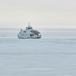
The ice disrupts ferry traffic between the islands and the mainland. It also makes winter navigation more difficult. Satellite images allow us to see the spread and changes in the ice.
Satellite images also assist in planning winter navigation. They have been used since the 1980s. Today, sensors and satellites are more advanced, providing more accurate information about the marine environment.
This winter has been more icy compared to the last 10 years. However, when looking at the winters of the last 30 years, this winter is rather typical. In extreme winters, even more ice has covered the Baltic Sea.
In early February, more ice could form. Forecasts indicate that the ice could cover up to half of the Baltic Sea. This means that almost the entire sea surrounding Estonia could freeze.
In the future, winters will be shorter and less cold. The climate is warming, but this is not a continuous process. There may still be cold winters in the future, affecting ports, shipping, and wind farms.
Ice condition forecasts help in planning maritime activities. For example, they can predict where ice piles may form, obstructing shipping.
In the future, it will be important to analyze both past climate data and future projections. This will help in better planning coastal and offshore structures. Tallinn University of Technology is also developing digital twin solutions for the sea, which will help better understand marine processes and make more accurate forecasts.