
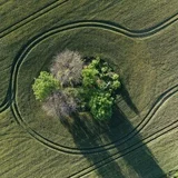
In the middle of fields, you can see small wooded areas with stones. These are field islets. These islets formed when stones were removed from the fields. Later, the islets grew into forests and became habitats for animals and birds.
University of Tartu geoinformatics professor Evlyn Uuemaa says that subsidies are paid for field islets. They are beneficial for nature. Various plants grow there, and they provide habitat for animals.
Currently, farmers must manually mark the locations of field islets on the PRIA website. This takes a lot of time, and the data quickly becomes outdated. University of Tartu researchers used artificial intelligence to identify field islets. The machine analyzed images and supplemented farmers' data.
The researchers found 10,000 new field islets. Previously, 30,000 islets were known. Geoinformatics expert Holger Virro says their model identified many more islets. The existing data was not incorrect, but it was difficult to update.
The researchers used a neural network to identify islets. They trained the machine with 15,000 images of field islets. In the same way, other objects such as hedges and stone fences can be identified in the future.
PRIA has already received the map created by the researchers. They want to investigate whether they can use it automatically in the future. They want to monitor how field islets change.
The researchers hope that PRIA will adopt their model. They have also considered how to continue their research. They want to use satellite data because it is updated every week. They plan to conduct research in other European countries as well.