Google Maps is a private company's mapping application. It allows users to supplement data themselves, which can lead to the creation of misinformation.
National mapping applications are different. For example, the Land Board creates accurate and reliable data. They have a very low chance of containing misinformation.
Google Maps uses open data and user suggestions. However, local context is not always considered. Therefore, misinformation may go unnoticed.
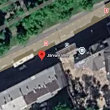
For example, in Google Maps, there is a false historical object named "Järvani alley" on Kaarli Boulevard in Tallinn. It was added as a joke.
Tallinn's deputy mayor Kristjan Järvan is aware of this. He does not plan to remove it. He thinks it's good humor.
If you find misinformation, contact the platform. Request the removal of misinformation. The problem persists as long as people add false information.